
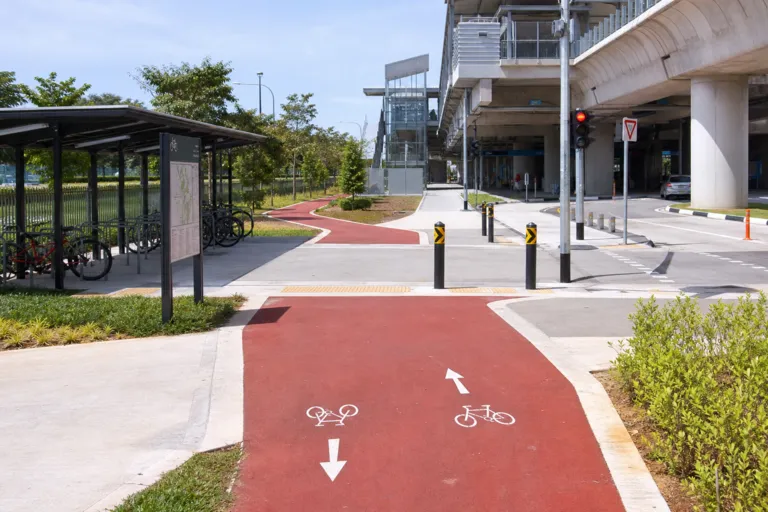
Singapore is positioning cycling as part of a broader push to make Walk-Cycle-Ride the preferred way to travel. The National Climate Change Secretariat (NCCS) states that, to encourage Active Mobility, Singapore will expand the cycling path network to around 1,300 km islandwide by 2030 under the Islandwide Cycling Network Programme. The same NCCS page also frames this within land transport’s role in national emissions, noting that Singapore’s land transport system accounts for about 15% of carbon emissions in Singapore. In parallel, the plan includes repurposing suitable stretches of road into wider footpaths, cycling paths, or bus lanes to better support cycling and walking.
In practice, cycling remains a small slice of daily movement today. Wikipedia’s overview of cycling in Singapore describes it as a developing mode of transportation that continues to grow, but it also says cycling remains niche, with only 1% of trips being done on bicycle. The same source highlights a common rider experience: off-road paths are viewed as discontinuous, while on-road cycling can be dangerous for cyclists. That tension—between expanding path length and making everyday cycling feel continuous and safe—helps explain why a network headline can coexist with limited mode share.
Why Connectivity Matters More Than Kilometres
A public analysis from Hack for Public Good argues that the problem is not simply a lack of cycling paths, because Singapore is building towards 1,300 km by 2030. Instead, it warns that progress reporting often focuses on total kilometres built, which does not capture whether paths connect into a usable network for daily trips. Using an assessment of 203 MRT and LRT stations, the analysis reports that 42% have poor cycling connectivity. It also finds that cyclists face an average of 12 interruptions per kilometre around stations, a real-world friction that can turn a theoretically short ride into a stop-start experience.
The same station-focused analysis adds detail on infrastructure coverage relative to surrounding roads. It reports an average cycling-to-road ratio of 19.7%, described as just below the 20% “good” threshold, and a median of 11.5%. Only 25% of stations are rated as having good or excellent cycling infrastructure. The study notes that making network gaps, desire paths, and usability issues visible at a local scale can help unlock targeted interventions, including potential action by town councils where central prioritisation is constrained. This shifts the conversation from distance targets to practical links between homes, stations, and key destinations.
Viewed together, the Singapore islandwide cycling network 2030 ambition is best understood as a combination of scale and usability. Official policy signals a large islandwide build-out to around 1,300 km and the reallocation of some road space to support walking and cycling. At the same time, independent findings highlight where riders may still struggle—particularly around rail stations, where poor connectivity and frequent interruptions can undermine last-mile utility. The opportunity is to pair the network expansion with sharper, connectivity-first measures so cycling becomes not just possible, but straightforward for everyday trips.
What is Singapore’s cycling network target by 2030?
How big is cycling’s share of trips in Singapore today?
What does research say about cycling access around MRT and LRT stations?
Why can a kilometre target miss real-world usability?
How does the 2030 islandwide cycling network topic connect to climate goals?